


Voting District 1150772000002, Monroe County, Michigan
About
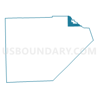
Outline

Summary
| Unique Area Identifier | 598377 |
| Name | Voting District 1150772000002 |
| County | Monroe County |
| State | Michigan |
| Area (square miles) | 7.86 |
| Land Area (square miles) | 7.74 |
| Water Area (square miles) | 0.13 |
| % of Land Area | 98.39 |
| % of Water Area | 1.61 |
| Latitude of the Internal Point | 42.05841250 |
| Longtitude of the Internal Point | -83.27542380 |
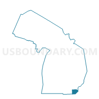
Maps

Graphs
Select a template below for downloading or customizing gragh for Voting District 1150772000002, Monroe County, Michigan


Neighbors
Neighoring Voting District (by Name) Neighboring Voting District on the Map
- Voting District 1150368000002, Monroe County, MI
- Voting District 1150368000003, Monroe County, MI
- Voting District 1150772000001, Monroe County, MI
- Voting District 1150772000003, Monroe County, MI
- Voting District 1631122000011, Wayne County, MI
- Voting District 1632836000001, Wayne County, MI
- Voting District 1632836000002, Wayne County, MI
- Voting District 1632836000003, Wayne County, MI
- Voting District 1632836000004, Wayne County, MI
- Voting District 1636918000001, Wayne County, MI
Top 10 Neighboring County Subdivision (by Population) Neighboring County Subdivision on the Map
- Brownstown charter township, Wayne County, MI (30,627)
- Flat Rock city, Wayne County, MI (9,878)
- Berlin charter township, Monroe County, MI (9,299)
- Ash township, Monroe County, MI (7,783)
- Rockwood city, Wayne County, MI (3,289)
- Flat Rock city, Monroe County, MI (0)
Top 10 Neighboring Place (by Population) Neighboring Place on the Map
Top 10 Neighboring Unified School District (by Population) Neighboring Unified School District on the Map
- Gibraltar School District, MI (21,679)
- Airport Community School District, MI (19,050)
- Jefferson Schools, MI (12,789)
- Flat Rock Community Schools, MI (10,790)
Top 10 Neighboring State Legislative District Lower Chamber (by Population) Neighboring State Legislative District Lower Chamber on the Map
Top 10 Neighboring State Legislative District Upper Chamber (by Population) Neighboring State Legislative District Upper Chamber on the Map
Top 10 Neighboring 111th Congressional District (by Population) Neighboring 111th Congressional District on the Map
Top 10 Neighboring Census Tract (by Population) Neighboring Census Tract on the Map
- Census Tract 5990, Wayne County, MI (5,484)
- Census Tract 5991, Wayne County, MI (4,394)
- Census Tract 5920, Wayne County, MI (4,351)
- Census Tract 8303, Monroe County, MI (3,751)
- Census Tract 8301, Monroe County, MI (3,540)
- Census Tract 5980, Wayne County, MI (3,289)